Tuesday, September 2, 2008

100 Mile Picture

Appalachian Trail
Caution
There are no places to obtain supplies or get help until Abol Bridge 100 miles north. Do not attempt this section unless you have a minimum of 10 days supplies and are fully equiped. This is the longest wilderness section of the entire AT and should not be underestimated.
Good Hiking!
MATC

Sunrise at Antler's Campsite.


Rocko beat Philly is Rock, Paper, Scissor and won the right to blow the horn. This alerted the hostel to send a boat over for us.


Hangman with his 1lb deluxe Cheeseburger.


Philly and me fording a brook.

Baxter State Park

Baxter State Park is unlike all the other parks. Most of the land was donated by Percival Baxter, and he also set up a trust fund which means that the park does not rely on any outside funding. The park was set up to allow for the protection of the environment to be more important than allowing people access. As thru hikers we were able to enter without the normal out of state charge, but it became the one and only campsite that I had to pay for in the entire trip. It was also the only night I started a fire. We had been given some marshmallows and graham crackers, so after the acquisition of chocolate we made s'mores.
The next morning we started off nice and early to try and beat the Labor Day Weekend rush. Hangman was on the trail at 6:30 with his friend, while Rocko, Philly and I started at 7am. We quickly caught Hangman, his friend and the other 7 people who had started earlier than us. We had left our packs at the Ranger Station with notes for the people picking us up on where to meet us. When we hit tree line and started rock climbing, we were very happy to have left our big packs behind. After about a mile of tough rock scrambling and some views we made it into the clouds. From there it was an easy walk to the summit, although we were unable to tell how close we were until we reached the summit.
It is hard to describe the mixture of emotions. I had been hiking toward this destination for 5 and a half months. Now I was standing at the sign. I had seen pictures of people in front of this sign throughout the trip. Now I was there. At times it had seemed so far away, too far away to contemplate. Then in the 100-mile Wilderness it finally felt reachable. There is a mixture of happiness that you have attained your goal, and sadness that you no longer have that goal to strive for.
We spent close to an hour up there, taking pictures, drinking beer and talking to people. Hangman's friend had turned around at tree line and Hangman caught back up to us at the summit. Everyone on the summit had climbed up themselves, and everyone knew about the trail. It was obvious that we had just completed the whole thing and we were almost celebrities. Finally the cloud and the mist and cold got to us and we started to make our way down.
We went across the Knife's Edge Ridge. The 1.1 miles took us an hour and a half. We were in a cloud most of the way so it was harder to appreciate the shear drop offs on either side. This was 1.1 miles of boulder scrambling with a path that at times was only 3 feet wide with 1,000 foot drop offs on either side. A truly impressive way to come down off the mountain.
From there we went down the Helon Taylor trail and arrived just about the same time my parents did, who met us with fresh fruit and cookies. When I tried to hug them, I was turned away with a handshake. No more physical contact until I had showered. The drive to Bangor was cold since we had to keep the windows down the whole way.
After a shower and my long awaited hugs my parents took Philly and me out to dinner. We went to a brew pub with great beer and seafood. I was able to have the meal I had been dreaming about, clam chowder, mussels, lobster, fries and a brownie sundae. We even ran into several people we had seen hiking that day who bought us beer. I was able to enjoy my 15 minutes of fame.

Rain

From Vermont until part way through Maine we were rained on everyday. Just under a month straight. The heaviest rain was in New Hampshire and several streams that used to be easy rock hops were now tough fords.


At times the entire trail was under water. this is not a stream, it is the trail.


In several places there were log bridges oing over the muddy sections. These bridges were frequently underwater.


When the trail was too close to a brook, sometimes the brook took over.


This brook was not supposed to be a ford.

100 Mile Wilderness

After a 5x5x5x5 (pancakes, eggs, bacon and home fires) breakfast at Shaw's and a resupply for 7 days Rocko, Philly and I were ready for the 100 Mile Wilderness. In the past, this was a 100 mile stretch with no access points and no resupplies. However some of the private logging roads are now open for public use and there are 2 hostels, one five miles in and the other 70 miles in. There are signs at each end warning people to make sure that they have at least ten days worth of food. At this point my pack was not big enough for ten days of food, nor did I want to carry that much. Also after hiking for 2,000 miles in the last 5 months, we were confident that we could hike 100 miles in around 7 days without pushing ourselves. We started hiking with Rusty Rat and Meat Hook, but they were planning on one less day through the wilderness, so they quickly moved ahead of us. With our late start, but still a day ahead of my original schedule we took an easy 10 miles to the second lean-to.
The next morning we met up with Hangman. Hangman had hiked through the Whites with Philly, but was planning on summiting a day after me. I had wondered when we would catch and then pass him. This was also the first of two days with mountains in the wilderness, and we were not moving very fast. We did not reach our destination, only 15.6 miles away, until about 6:30pm. Part of the reason was the good weather, which made it easier to take long breaks on the moutain tops. Our destination ended up being one of the worst lean-tos in Maine. However that day I learned what was behind the "Green Glass Door" and why I like coffee, but I do not like tea. Both of those are riddles that Rocko tried to torment us with.
The next day was another mountainous day and we were hoping for our first glimpse of Katahdin. There were other mountains earleri in Maine that were supposed to have views, but the visibility had never been good enough. Finally at the end of the day on White Cap mountain we had our first view of Katahdin. It was in the clouds. We finished our cold day at a lean-to with a cold stream that had a pool big enough for bathing. I was the only one smart/stupid enough to go in and wash off.
The next day started off cold but warmed up and did not have a mountain in our way. We cruised 19.6 to a beautiful campsite on a pond. Philly and I swam on the sunny side of the point and enjoyed a privy with curtains and a sink. However, the sink had neither a faucet nor a drain. The next morning we had a gorgeous sunrise over the pond. Getting to the campsite put us in position to arrive at White House Landing in time for lunch. They have a very strict 11-1 lunch time, so we were aiming for getting there around 10:45. From the AT there is a blue blaze trail that leads you 1.2 miles to a dock on a lake with an air horn. You blow one short blast, and only one, and very short, and they send a boat over to pick you up. Hangman, Philly and I each had a 1lb burger. We all ordered the deluxe version. It was 9 for the burger, 10 if you want cheese or 11 if you also want lettuce and tomatoe. Afterwards we were all still hungry and split a pizza with Rocko. With the $3 per person for the boat ride it ended up being a very expensive lunch, but fun. With the return boat ride we were left a mile closer to the AT. We then continued, slowly, onto another lean-to near a lake for some more swimming.
On our last day in the wilderness we went around Rainbow lake and then onto Rainbow ledges with lots of good blueberries and a very impressive view of Katahdin. We were now 20 trail miles away and it started to look very intimidating. then on to Hurd Brook lean-to which was the one and only time I slept in a shelter that still had the "baseball bat" design for a sleeping platform. Instead of planks, we were sleeping on round saplings. Fortunately, it was hard to tell the difference under my thermarest.
The next morning it was an easy 3.5 out of the wilderness and to the Abol Bridge campground. I managed to walk out of the wilderness with almost no food. But I knew there was beer waiting at the campground, just not a good selection. We all drank some beer, had lunch and made sure we had enough food to get up and over the summit. We also realized that it was bear season when a pickup truck pulled in with two kids on lawn chairs in the bed, next to a dead black bear.
Hangman had been in touch with his friend picking him up and decided to that he would be able to summit with us. So the four of us, with a nice buzz going, entered Baxter State Park.

Mountains of Maine

Rocko and I on top of Baldplate Mtn, 3,662 ft


Bigelow Mtn, Avery Peak, 3,850 ft. Philly spent a rainy night in the watchtower.


Bigelow Mtn the following day, still in the clouds.


Moxie Bald Mtn, 2629 ft


A view of Mt Katahdin 5,268 ft from Rainbow ledges.

Mountains of New Hampshire

Shadow Cast on top of Mt Lincoln, 5,089 ft


Me on Top of South Kinsman, 4,358 ft


South Twin Mtn, 4,902 ft


Mt Webster, 3,910 ft


Mt. Madison 5,363 ft.

Blown Away

Rocko and I left Stratton together with a slightly sketchy ride. As we were walking to the post office another hiker with a car asked us if we were heading back to the trail. We said yes, but we had to go to the post office first. When we left the post office he was waiting in the parking lot and again offered a ride. He was a nice older section hiker, we were just weirded out that he had been waiting in the post office parking lot for us. I guess that you could also consider it very nice since he was going out of his way to give us a ride.
That night it had rained heavily, but the forecast was for the weather to clear. It was very cloudy and windy that day, although the wind did seem to be blowing the clouds away, slowly. I had just planned on getting to the first lean-to that night so when we got there for lunch and pushed on, all the extra miles put us ahead of schedule. We went over the Bigelows which most people were saying was the last really hard stretch until Katahdin. As we hiked over the ridge we were almost blown away, literally. It was possibly the windiest day on the hike. Several times I was knocked over a step or two, and once I was blown over. However, we had views, we just did not stand around too long enjoying them. We made it over the main ridge to Safford Notch Campsite for the night. We arrived late and the tentsites left were not the best. I was unable to set up my tent and I had to cowboy camp, or sleep under the stars. It was the coldest night for me in months and I was very glad I had my warm sleeping bag.
The next day Rocko and I decided to hike 22 miles. This would put us at a shelter with a gorgeous view of a lake, and right next to a sport camp where we could get pancakes in the morning. The terrain was nice and easy, for a change. We passed the 2,000 mile mark. At the next road crossing someone had spray painted "2,000 mi" in the road. After taking pictures someone in a camper drove by. I thought, stop and give us soda. He stopped right next to the sign and asked us how far we had come. We replied, "2,000 miles. You can see the sign in the road." He asked us several other questions, but did not look at the sign or give us any soda. We continued on and arrived at the lean-to around 6. We signed up for our 12 pancake breakfast in the morning and enjoyed dinner on the lake watching the sunset.
The following morning we enjoyed our 12 patriotic pancakes. They were red, white and blue from raspberries, apples and blueberries, and were absolutely amazing. As usual I left full, but nowhere near stuffed. Rocko took 4 for the road. Now, on to the crossing of the Kennebec river. The official trail is the ferry. The Maine Appalachian Trail Club (MATC) hires someone to run a canoe ferry across the river. It is a wide crossing with a variable flow dam upstream, which makes it the most dangerous crossing on the trail. We arrived soon after the ferry opened for the day and Rocko paddled while I took pictures. Later on that day Rocko's knee started bothering her and then she broke her toe. Instead of pushing on she decided to stop for the day, then get a ride and meet me in Monson. That way she could let her knee rest and still finish with me. I pushed on and hiked with Rusty Rat and Meat Hook, a father and son team from Nova Scotia.
Since I was ten miles ahead of schedule at that point I decided to hike into Monson the next day and meet up with Filadelfia who was waiting for me. Rocko also made it to town at the same time. On the way into Monson there is a blue-blaze trail that elimnates the need to hitch into town and skips 3.3 miles of trail. I took this trail to cut a 22 miles day into a 21 mile day. Then I got a ride into town which shortened the day by another 1.5 miles. So for those of you scoring at home, I did not hike the entire 2,176 miles of trail. With the amount I cut off here and in other places, I only hiked about 2,172. Please do not report me to the Appalchian Trail Club which certifies thru-hikers. Although since they give out 2,000 miler patches, I think I am OK.
In Monson that night I went out to the AYCE fish fry. In retrospect, not a great idea. I have not had that much fried food in a long time, and Shaw's, where I was staying has a famous AYCE breakfast. My stomach told me over the next couple of days that that much fried food is not good. I was also only able to get one extra plate. Oh well.

Katahdin


Relief, exhaustion, supplication.


Ecstasy, excitement, accomplishment.


Conquest and stupidity. L to R, Filadelfia Greenberg, Me, Hangman, Rocko


Refreshment and celebration.


The Knife's Edge Ridge on the way down.

Sunday, August 31, 2008

Another Cloudy Summit

I am currently in Bangor, ME. I summitted yesterday with Rocko, Filadelfia Greenberg and Hangman. In keeping with the rest of the trip after gorgeous weather through the 100 mile wilderness we summitted Katahdin completely in a cloud. I will be driving back to NYC with my parents today and then staying in NYC for about 10 days. During that time I will update my blog on my travels from Stratton to Katahdin and add pictures.
Right now it just feels a little weird, like I am taking a zero day, but not really. I think in a couple of days it will sink in that I have actually finished. I have been hiking almost every day for the last 5 and a hlaf months and it feels a bit weird to stop. For the longest time Katahdin was this big thing, very fay away, then it was close, and finally I was on top. Now it is in the past. However while on trail I had been focused on finshing and being able to stop, I am still half thinking that I need to pack my bag and start hiking. Instead I will enjoy a continental breakfast and get in a car.
Now that I am back in the 21 century I would love to get back in contact, so feel free to email me at berlissj@hotmail.com or call at 305-360-1339, and I will actaully respond within a reasonable amount of time.

Monday, August 18, 2008

The Hardest Mile

I am currently in Stratton, ME 1,987 miles from Springer and 187 to Katahdin. I am staying at a hostel with Rocko after having left Shadow behind this morning. It was a combination or personality conflicts finally going beyond the point of no return and him not being able keep the pace I now need to follow. So while I am showered and curently sitting in a towel waiting for my clothes to get clean, he is taking a zero day, recovering at the last shelter.
We got a late start in the rain from Gorham after taking care of mail and hiked 11 not too bad miles to the first shelter. This was one of the few shelters with a view. However it was raining. From there we went on into Maine. We were now in the promised land. However the milage was tough. We arroved at the shelter before Mahoosuc Notch and realized it had taken us until almost 3pm to hike 11 miles. We decided that with the rain we had seen we would not attempt the hardest mile on the AT. The next morning we went into Mahoosuc Notch and up Mahoosuc Arm. For the five miles from shelter to shelter we took 4 and a half hours with one major fall. Luckily it only resulted in bruised shins. Mahoosuc Notch is a mile of crawling over, around and under boulders and crevices. At that shelter I realized my water filter had fallen out during the traverse through the notch. I left a note in the sheter journal about it with my phone number. I just received a phone call from someone who had seen it 15 feet down an unreachable crevice. It is a sacrifice to the trail gods. Fortunately I had enough iodine to get to the next town. We then pushed on, but had to call it again after about 12 miles for the day. At the road before the shelter we were all feeling a bit down and we took a bit of a long break. Then the park ranger drove into the parking lot and offered us sodas. He told us about the wonderful trail magic that took place earlier in the day. We were a bit saddened, but then that church group came back and reheated chili for us and made the day all better.
The next day we saw something unusual, the sun. We went up and over the Baldplates and I was able to see Mt. Washington for the first time. We were now 70 trail miles away. I did not see it at all in New Hampshire, even when I went over it. It was gorgeous to be in the sun again and see the beuatiful Maine landscape.
The next day Rocko again had to go into town for a mail drop and Shadow and I continued on. Instead of coming back to the trail on the same road, Rocko went ten miles ahead so Shadow and I had to catch her. We were unable to that day. We had another tough 12.8 miles to the next shelter and when we got there Shadow took his pack off and immediately fell asleep. At this point I had slowed down too much to wait for him to get better. I needed to go further to be able to get in and out of Rangeley the next day to get back on schedule. So I needed to push on, and Shadow refused to stop despite his obvious need for rest. We camped that night near the next stream and I let him know that I could no longer afford to wait for him at any point. That night we recieved a couple of drops of rain to end my sunny day streak at 1. That is correct, only one day without rain since I crossed into Vermont.
In Rangeley the next day we met up with Rocko and waited out a rainstorm while eating lunch. We continued out of town to the shelter sponsored by L.L. Bean. This shelter had a privy with two seats and a cribbage board between the two seats. Unfortunately no one else at the shelter knew how to play. I left last that morning and ended up at the next shelter before Shadow and Rocko. I got very worried and left messages with several southbounders for them. It turns out that they took a wrong turn and I passed them when they were off trail. Shadow came into the shelter in a foul mood and looking horrible so I left him alone for a while. Later we had our last blow up and we are now going our seperate ways. I left early the next morning without a goodbye and I am now listening to the rain outside while I am watching the olympics inside. Only one more town stop before Katahdin

Into the Clouds, Part II

My last entry on my saga through the white (or cloudy) mountains of New Hampshire ended with me, Shadow and Rocko at Zealand Falls Hut for the night. From there we went on to Mizpah Hut. Rocko did not make it that night since she needed to pick up a mail drop and ended up staying at the campgrounds. That day ended with one of the two climbs that I will absolutely never go down, and definitely not in the rain. The Webster-Jackson Trail was hard enough ascending in the rain, do not go the other way. Mizpah is a great hut for a thru hiker. They have a library. So Shadow, Dartman and myself hung out up there during dinner, out of sight and out of mind. We then had a lovely ham dinner with the croo before retiring to the library for bed. By sleeping up there we were also able to sleep through breakfast. That extra hour and a half of rest was well appreciated.
Our next day was the Presidential tranverse. This is the one day that we had been hoping for good weather on. At least we did not get rained on. We hiked in a cloud across all the southern Persidentials and to the top of Mt. Washington. We took lunch up there with all the people who drove and took the railway up the mountain. We even wrote postcards and mailed them. From there we went on to the Northern Presidentials. As we got into the cols between the peaks we finally dropped out of the clouds and were able to enjoy some of the lovely scenery. Suprisingly enough the AT does not go over the summits, except for Washington. But there are short side trails or loops to all of them. We chose to skip all of the optional peaks since they were in the clouds. As we approached Adams, I really wanted to go up, but I was hearing thunder, so we pressed on on Madison Spring Hut. This is the hut with the friendliest crew. I even went to Carleton with one of them. Although he was a freshman when I was a senior so I did not know him, but we had friends in common. There were four other southbounders at the hut that night, but our work for stay was a thru hiker program. So for about an hour we talked witht the guests and answered their questions. Then we went back to the kitchen and had a beer with the croo.
The next day from Madison to Carter Huts was another rainy miserable day. We had debated not staying at Cartern Notch Hut since we had been hearing that they were very unfriendly to hikers. However we were able to get a note of introduction from the Madison Croo, so we decided to chance it. First we had to go over the Wildcats. The Wildcat Ridge trail is the other trail I will never go down. Especially not in the rain. There is a gondola, if you have the choice this is a much better option. When we got to the hut we handed our letter to the hut master and we were let in. Although the hutmaster did live up to her reputation of not being friendly (the ice queen), and it was the worst food of all the huts. It is amazing how far a little salt can go in making food edible.
Now we were out of the whites and had a relatively smooth ride into Gorham. We did not go all the way at once since we needed to pick up mail and we wanted to avoid two nights in town. We stopped short and the next day strolled into town and a day of watching the Olympics and drinking beer.

Monday, August 11, 2008

Into the Clouds, part 1

I am currently in Gorham, NH 1,878 miles from Springer and only 297 to Katahdin. This leaves me with 19 days to do the 292 miles to Baxter State Park and summit on the 30th. So I need to average 15.5 miles a day for the next three weeks. Hopefully it should not be too hard, but the weather recently has been awful. I have been rained on everyday since I got into Vermont. Through the White Mountains we were either getting rained or, or walking in a cloud or both. Very few mountains gave us any kind of view. It also looks like the rain will not be stoppping any time soon. So I am ready to get wet and stay wet.
Update on Shadow Cast. He ended up spending two full nights in the hospital in Plymouth, and then we spent the next night in town to rest up a little more (John and Cathy, thank you very much). He left with a presciption for an anti-biotic which is messing with his stomach, and a steroid, which is messing with his mood. He has been able to make the miles we need to do, but is slower than his normal self. He is almost finished with the medications, and he hopes to be back to full speed in a day or two.
When we left Plymouth we took an easy day to the base of Mt. Moosilauke. This was our first big climb since Virginia. The next day we went up the easy side and had some views, but we also saw a big rain cloud moving in and did not stay too long. Coming down we had our first taste of wooden steps attached to the rock face. This was the first of many horrible descents in the Whites. We then puched on through Kinsman Notch and over the never ending Mt. Wolf before stopping at Eliza Brook Shelter. It had been raining the last two hours of the hike. After we arrived several more Southbounders showed up and we had 7 in a six person shelter. Then the heavens opened up.
The next morning Eliza Brook was a hip deep ford. The night before it had been a rock hop. We hiked over the log bridges that take you over mud pits where our ankles were under water. We then continued over the Kinsmans and past Lonesome Lake Hut (great pancakes) and into Lincoln for a night at Chet's Place. Chet hosts through hikers in his garage and is one of the nicest people around. He was injured in a stove explosion the day before he was going to start his thru hike, and has made an amazing recovery. At Chet's we met back up with Rocko who had been instrumental in convincing Shadow to get medical help.
From Franconia Notch we started our hut to hut trip. The huts in the White Mountains are run by the Appalchian Mountain Club (AMC), and offer food and lodging. They will also let two or more thru hikers to "work for stay." We then get leftovers from dinner and breakfast and sleep in the common room. Our first stay was at Greenleaf Hut. We went up and over the Franconia Ridge in a cold, windy cloud and then went the mile off the trail after Lafayette down to the hut. Although we were too early, they kindly let us stay. Normally they want you to arrive after 3, we were there at 1:40. We did not know what to expect, but the food was good and plentiful, and they kept looking for more work for us to do. In the morning we finally had to say that we needed to hike and had to leave.
That day we decided to skip Galehead and go on to Zealand Falls. The first 7.7 to Galehead was very tough and cold and wet and we were behind schedule when we arrived at Galehead for lunch. Their soup was not hot, so I passed and just had my own snacks. From there we cruised to Zealand and arrived at 5:55, when dinner is served at 6. They said their bosss was there that night and they are only technically allowed to have 2 thru hikers, and we were numbers 6 and 7, but they don't want to turn anyone away, so they let up stay
To be continued when I have more time.

Thursday, July 31, 2008

Shelter Journals

Most of the shelters along the trail, as well as stores that cater to hikers and some points of interest, have journals. These are a great way for hikers to keep track of one another. This way you can see who is ahead of you and how far. It is not completely accurate, I have been known to get the date wrong from time to time and not everyone signs in every journal. Some people do not sign in at all. People also leave messages for those behind them or recommendations on places to stay or restaurants to eat in. If a business pisses off a hiker word will get out about it very quickly. Not all of the messages are that interesting. Most people say whether they are stopping for the night, or if it just a quick break, and do a quick synopsis of their day. Others simply right "in for the night," or "stopped for lunch." These are pointless to me. They are great for finding out when someone came through and whether they are going faster than you or not. But it is not very satisfying to read. Since I am not carrying a book, I am looking for something more entertaining. This is why I also try to be more entertaining in my entries. I try not to say anything about the weather or the trail. You can tell if it was hot or raining that day based on other peoples' entries. Also why talk about the terrain, everyone who is reading it just did the same miles, or is about to. It is also annoying to brag about how many miles you have done that day. I am happy that you were able to do 17 miles before lunch, but do you have fun?
When people have passed me, I have often heard them say that they have been following along with what I have been writing or that they particularly liked one entry or another. Several of my posts, such as the cult post, started out as a journal entry. But for the most part they are very different from my blog. The blog is to keep the people off the trail informed about what I am doing and what life is like on the trail. The journal entries are for people on the trail. They know what trail life is like, so I talk about other things. I have told lots of stories unrelated to hiking. There is another Nekton employee on the trail, so I have been telling boat stories for him. Recently Shadow, Filidelfia and I have been making up stories about the horrible things that Shadow has done to South bounders. All in the hopes that we can make some people laugh.

Wednesday, July 30, 2008

Trail Families

One thing you have on the AT are trail families. While most people start the hike on their own, they rarely hike the whole way on their own. Sometimes you meet up with one person and hike with them for a couple of days, other times you get together with a whole group and spend several months with them.
They are many advantages to hiking in a group. When you get into a town you can split a shuttle or a hotel room several ways and make it more affordable. Also if something goes wrong while in the woods you have multiple people to help you out. You also have a support network of people who are keeping you motivated and on trail. You also then have a wider network of contacts for places to stay along the trail.
Trail families tend to be fairly fluid. Since you did not start the trail together there is not as much pressure to finish together. If people have different speeds or different needs, they do not have to stay together. However it gets harder and harder to enter a trail family as you go further. Some tend to close up once they have formed, or you have people who have hiked together for months and no matter what an additional person will feel like an outsider.
Some families take on names, I have been in the Kielbasa Klub at one point and I am currently in Aggressive Male Nudity (Amen). A friend who hike last year was in the Iron Chefs (because of their cooking skills), and currently on trail we have the 4 Sisters, The Invisible Hillbillies, The Pain Train and The Main train to name a few.

Unexpected Stop

I am currently in Plymouth, NH which is not right on the trail. This was not an intentional stop, but a necessary one. On Saturday Shadow was stung or bitten by something. We are not sure what, and we did not think we will ever found out. This bite became infected and yesterday Shadow came down with a fever and chills. After some discussion and argument, Filadelfia, Rocko and I succeeded in convincing Shadow that he needed to get off the trail that night and into a hospital. After a five mile hike, the last three of which was with head lamps, Shadow and I were met at the trail head and driven 25 miles into Plymouth. On the way into town I was able to call the parents of the person I stayed with in Hanover and arrange a place to stay the night. Shadow was admitted and given antibiotics and told to spend the night. He will be staying tonight as well, but is doing much better. We are currently trying to figure out where and when we will meet back up with Filadelfia and Rocko and continue on.

Sunday, July 27, 2008

3 nights with the Twelve Tribes

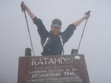
I am currently in Hanover, NH 1735 miles from Springer and 441 miles to Katahdin. I am staying with a friend of a friend just outside of Hanover. Right now I am happy to be out of the rain. It rained every single day I was in Vermont. Vermont was a state known for muddy trails, and all the rain did not help at all. Because of the rain we decided to spend a couple of nights based out of Rutland. We had heard that the Back Home Again cafe had a free hostel that provided dinner and breakfast. The cafe is run by the Twelve Tribes community in Rutland, www.twelvetribes.com. Contrary to the title, they are not a cult. They are a community based on love and their own particular brand of Christianity. They also provide a large amount of good food. We st around and talked about their community and way they had given up everything to join. On Wednesday while walking in the we called them and arraigned a pickup. We spent Wednesday night with them, and then on Thursday got a ride back to where we left the trail and slack packed back to Rutland. On Friday we got a ride twenty-three miles North on the trail and hiked back, and then on Saturday continued back on the trail with real packs. Two days of slack packing and three nights of great food was very worthwhile. Part of the way they support their community is through maté tea and energy bars. We may now be addicted. However, the highlight from our stay was being invited to Shabbat dinner. There were testimonials, singing, dancing, interesting conversation and lots of good food. In addition to lasagna we had broccoli fresh from their farm. It was amazing. I had two full plates and was still full the next morning when it was time for breakfast. Breakfast that morning was stuffed french toast and their home made maple syrup. That day was one of the hardest days of hiking I had in a while. We were back to full packs and had a major case of the ITIS. We (Filadelfia, Shadow and myself) were unable to move. But eventually we were able to finish our 17 miles.
Back to my out of order narration. My last full post was in Dalton. From there Shadow and I moved into Vermont and the mud. Our first night in VT it rained right after we arrived at the Shelter. We ran into Filadelfia and Creek Diver, and Filadelfia announced where we stood on his list of the top ten thru hikers he would eat if he had to resort to cannibalism. I was number 6, Shadow number 7 and Creek Diver number 9. I have not yet been with Filadelfia and anyone higher up on his list. I think that it is incentive for me to keep him well fed. The next day Creek Diver went to meet her family and Filadelfia joined us.
Vermont has a series of shelters and campgrounds that you have to pay for, so we planned our days around avoiding these shelters. Most of them are around ponds, and as we came upon one of them a loon was swimming by and spent several minutes calling out to us. It was my first, and hopefully not my last, loon of the trip. Earlier that day the caretaker on Stratton Mountain had warned us about potential torrential rains that night. The weather did not disappoint. Shadow had some camp soap and Filadelfia and I decided to take a shower in the rain. It started coming down, we lathered up, and then the rain let up. We waited a couple of minutes and then walked over to the nearby stream to rinse off. Then it started raining heavily again.
One thing Shadow and I had been talking about since the Indiana Jones movie was seeing the new Batman movie when it came out. We needed to resupply in Manchester Center, and that ended up being a perfect opportunity. We started our laundry, got some lunch and then saw Batman. It was everything we had hoped for and more. We then bought more groceries and went back out on trail. That night we met back up with Greenwood who joined us the next day. We finished at a shelter next to a stream with good bathing opportunities. We went in and Shadow, Filadelfia and I all stripped down, while Greenwood kept his clothes. We decided to call ourselves Aggressive Male Nudity, or Amen for short. I think we scarred Greenwood for life and he has not hiked with us since.
Then the rains started during the day. After hiking for most of the day in the rain we called ahead to the Twelve Tribes and had them pick us up so we could dry off. Our first day of slack packing it rained the whole time and the trail was soaked. At times the water was above my ankles in the middle of the trail. We were very happy to get back to the hostel than night. The second day of slack packing was sunny and beautiful, but the trail was still wet and our shoes ended up just as muddy and wet. Yesterday started sunny and the trail was mostly dry, but it still rained all night. I was very happy to get into town today and do laundry.
Tomorrow we will probably head out with Rocko who has now returned to the trail, but one of the packages I sent from NYC did not yet arrive so I need to figure out what to do about that first. Later this week we get into the White Mountains and the rocks and views. We are now back in the realm of long steep climbs. It should be fun.

Wednesday, July 23, 2008

Rain in Vermud

I am currently in Rutland, VT. Trailwise I am at Vt 103, 17 miles south of town, but 500 miles from Katahdin. The end is getting closer and closer. It has rained on us (currently Shadow, Filadelphia Greenburg and myself) every day that we have been in Vermont. We are running 6 for 6, and tomorrow looks like it will be 7 for 7. With all the rain we decided to give the hostel in Rutland a call and see if they could pick us up on trail. So tomorrow we will get dropped off at that same spot and then hike back to town. This way we get two nights of accomodation out of the rain and we still get the same mileage done.
When we left Dalton we quickly crossed into Vermont and the mud. We had been warned about the mud in Vermont and once we crossed over it began. Some people have remarked in the journals that it is not as hard on the feet as the roots or the rocks. However I have been stepping on all the roots and rocks to avoid the mud. So it has not been any easier on my feet.
I may be able to get back online tomorrow, but my time is close to running out today. One of our recent highlights spending the afternoon in Manchester Center and seeing the new Batman movie. It was a great way to spend an afternoon out of the rain. We then picked up out clothes from the laundromat and went back on the trail for a late afternoon 2 miles. Fortunately it was not as steep an out of town climb as we sometimes get.
Anyway here is hoping for more Sunshine when we get to New Hampshire.

Wednesday, July 16, 2008

Swimming in Nuclear Lake

I am currently in Dalton, MA about 1,554 miles from Springer and 622 from Katahdin. I am staying with Rob in the Birdcage. Rob was recommended by several other thru hikers I have talked with and by the mayor in Unionville, NY. So tonight Shadow and I are staying at his house. Rob works in North Adams which is about 23 miles north on the trail so tomorrow he will drop us off and we will hike back to his house, and then the day after continue from where we left off. This will be Shadow's first south bound slack pack. At first he did not believe in them, but since his mail drop has not yet arrived we have to be here tomorrow anyway, so it works out.
In the last ten days we were able to finish NY, get all the way through CT and 2/3 of the way through Mass. This is not from the blistering pace we have set (my feet are happy that it is not a blistering pace), but because these states are very short. By the end of the week we will be into VT and back into states that take over a week to hike through. It also looks like Shadow and I will be parting ways with the Peackock family. The last week or so we were meeting up for meals and at shelters, not really hiking together. Now they have decided to aim for a finish date about one week ater my goal date of Aug 31. This means they will be taking some slower days and more zeros.
I do not have my guide book with me to spark my memory nor do I have the time (only an hour on the computers in the library) to do a full blow by blow account of the time since my last update, but I can mention the highlights. One of which was swimming in Nuclear Lake. Nuclear Lake is in NY, but had been given a clean bill of health after previous testing regimes went on in the area. The lake was gorgeous and the 3 eyed fish did not bite too hard. It was a hot day and a shallow warm lake which made it a wonderful place for a midafternoon swim. It currently ranks after the YMCA lake in New Jersey and Upper Goose Pond for top simming holes on the AT. Two nights ago I stayed at Upper Goose Pond Cabin. This is a cabin with a caretaker right on the pond (it should really be called a lake) in Massachusetts. Shadow and I arrived at 1 and promptly went swimming. We had just finished 16 miles and were done for the day. It had been raining that morning but was starting to get nice and we were ready for a swim. It was wonderful. When Peacock and Daddy-O arrived at 6 it was now completely bright and sunny, so we went in again. There is an island in the middle of the lake and Peacock and I swam out there and sunned ourselves and then swam back. That night I played UNO with Shadow and Vegan (a section hiker from NY), and then had blueberry pancakes and coffee in the morning. That was what hiking should be all about. Blueberry pankcakes make the mornings that much better.
Earlier that evening Shadow and I attempted to play checkers. We ran into some disagreements about the rules. I was not aware that there are regional variations on the rules, but apparently there are "Southern Rules." Once a piece has been kinged Shadow says it can now move an unlimited number of spaces in one direction. It can even move three spaces and then jump over another piece. He tried that on me and at that point I forfeited the game in disgust. Since then I have been asking everyone I run into about these rules variations. No one else has heard about them. Not even the Southerners we have been hiking with. So if any of you know about these "Southern Rules" variations, I would love to hear it.
One of the nice things about New England is that we are back to good water sources and swimmable lakes and lots of blueberries. Several times I have picked enough blueberries for dessert and/or breakfast the next morning. The unfortunate down side of lots of good water is that we now have to deal with lots of mosquitos. I have been sleeping in my tent almost every night, and my Cutter Advanced protection does not cut it. When it comes to bug spray, use deet, or don't bother. The trail is also not as well marked. I think that I have lost my touch for route finding (I always lead and Shadow follows). I have lost the trail more oftern in the 54 miles that we have been in Massachsetts than I have in the previous 1500 miles. The one upside is that I know other people who have gotten lost at the same points on the trail. Is it that hard to put a sufficient amount of blazes on a trail and do a little maintenance? What makes it worse is that on one well groomed section we came across a maintainer who was painting blazes on almost every tree. So now we have a section where you can see the next seven white blazes, and others where you cannot even follow the trail. It makes no sense to me.

Sunday, July 6, 2008

Back on Trail

This will be my last post from NYC. Tomorrow we head back out to the trail, and I am ready to be moving on. This was my second full week off the trail (Trail days and Hardcore was the other week), and that is just a bit too long. I have the ants in my pants. I even went running in the park a couple of times. Not to stay in shape but to get some energy out so I could get to sleep. When you are used to hiking 15-20 miles a day, a couple of days of rest are good, but after 3 or 4 you are rested and you get anxious. I was able to get a lot of errands done for the trail and for moving out to Portland afterwards, but two pieces of mail that I was waiting for did not arrive. I did not receive my tax refund check which would have paid for a full month on the trail. I also do not receive my new backpack from Granite Gear. About a week before getting to NYC my 20 day old backpack developed a tear. I didn't have Granite Gear send me a new one right away because I thought that I would be able to get it switched out in NYC. However none of the outfitters that are Granite Gear dealers carry the backpacks. So they sent it on Monday and it did not arrive. So I will now get to see how long this pack will last with a tear. And everyone who reads my blog knows exactly which pieces of gear have failed and who is the best at replacing or repairing their gear. however when I arrived at home there was another pair of REI pants. There was a mix up and I received a second pair. So I now have two new pairs of pants, all for the price of shipping one pair back to REI.
While most of my NYC friends were out of town this weekend I was able to get into town before my parents left for their vacation, and I was able to see my grandparents three times. I was also able to eat out all the time since my parents are redoing the kitchen this summer. So currently there is a refridgerator and nothing else in the kitchen. No sinks, no cabinets, no nothing. I was unable to cook at all, just store milk for cereal in the morning.
At this point I am partly ready to get back to hiking, and partly ready just to finish the trail. I have heard that the upcoming trail is better than NY, but I was getting a bit depressed. I do not want to drop out at this point, but I am ready to be done. We will see if in a week or see things have improved. I am looking forward to getting to New Hampshire and the White Mountains. I did a lot of hiking there when I was younger and it will be nice to get back to familiar territory.
ps if any of you are feeling in the mood to mail something that will arrive my July 28th
Jeffrey Berliss
c/o General Delivery
Hold for AT Thru Hiker
Hanover, NH 03755

Saturday, July 5, 2008

Privies

I feel the need to write an entry about the privies on trail because the recent ones have been so bad. During the course of the first 1408 miles I have come across many privies, in all shapes and sizes and qualities. Some are composting, some are mouldering, some are solar activated, and some are just holes in the ground. Some are completely enclosed, others are open, fully or partially. Some have roofs, others do not. Some are very hard to find or far away from the shelter, others are in plain site of the shelter or the

trail. There have been privies with 0,1,3, or 4 walls. But I have not seen any with 2. The 1 wall is supposed to block the view from the shelter, but the 1 wall is not always well placed. Some walls go all the way to the roof, others do not. I have even come across some that are handicapped accessible. Since the AT is frequently on federal lands any new improvements to federal buildings have to be ADA compliant. These are nice because they have the ramp, and the handles to get up and there is always plenty of inside room. However, I am just not sure how anyone in a wheelchair could get there. In PA most of the privies were completely enclosed. I am not a big fan of this. Even in the middle of the day there is


not enough light to see so you have to prop the door open. These also tend to smell the worst and have the most animals living in them. You would be hard pressed to find one of these without a couple of spiders and/or mice living inside. NJ however has the worst privies. Most of them have no walls. This makes them slightly harder to find unless someone is sitting on it. I was able to talk to people passing on the trail from one of the privies in NJ.


Some of the privies in NJ were simply a box with a toilet seat above a hole. Two of the boxes were rotting away. One was so bad that you did not want to put your full weight on the seat because it looked like you might fall in. This was worse than in TN when all you had was a shovel or a trowel at the shelter. At least there you knew what you were getting into, or should I say onto? My worst experience was at a privy where the door and the lid had been left open. A number of flies had then descended into

the hole. When I sat down they were now trapped. They all buzzed straight under my butt and tickled as things were dropping. I had to lift a leg to let them escape. Right now I will just appreciate my parent's flush toilets and make sure I have a full roll of trail tickets, or mountain money, or TP or whatever you want to call it.

Thursday, July 3, 2008

End of PA

I would like to encourage all of you reading my blogs at some point to either comment, send me an email or a real letter. I have very little idea of whether my bogs are being red. When I talk to people I have gotten a very positive response, but it would be nice to get some encouragement while on trail. My next definite mail stop will be in Hanover, NH. So if any of you feel like writing you can send something to
Jeffrey Berliss
General Delivery
Hold for AT Thru Hiker
Hanover, NH 03755
I am aiming to be there around July 28. From there it is about a month more to Katahdin and I have not figured out mail drops for anything beyond Hanover.
I think my Pa tale needs to restart in Duncannon. I stayed at the historic Doyle Hotel which around 1905 was a five star hotel. It does not look like any money has been spent to improve the hotel since then. I was able to get a single with no AC and shared bath for 25 a night. I am pretty sure the sheets were clean. However this is where all the hikers coming through stayed, the food was good and the beer cheap. I happily spent the night hanging out with other hikers and enjoying cold local refreshment. Peacock and I enjoyed a late start and breakfast at Goodie's the next morning and hit the trail at around noon. PA continued its trend of long flat ridges with lots of rocks and no views. At this point I am not remembering too much of interest before Port Clinton.
The shelters in PA have a tendency to be very close to roads. 501 Shelter which was right off of PA 501 was not an exception. However it did have bunkbeds and a solar shower. The general idea with a solar shower is that the holding tanks have an opportunity to warm up during the day. This concept was lost on whomever built this one. It did have soap, but I described the temperature as "I have bathed in colder streams." The water also came from the same holding tanks, so the drinking water was warm and the shower water was cold. This was also a shelter where you could order pizza. I was starting to have NYC on my mind and I had too much food so I just cooked but I was offered a slice of someone else's pizza. I did not miss anything by not ordering my own. It may have been the worst pizza I have had on trail.
We decided to hike the 24 miles into Port Clinton the next day. Peacock and Daddy-O set up a slack pack while Shadow and I felt cheap and decided to hike our packs down. Shadow and I set out early and we were in the local outfitter by 3 enjoying Ben and Jerry's. The last 1/2 mile into town was straight down a 45 degree loose rock slope. I have never been happier to have trekking poles than that descent. If I had a piece of cardboard to slide down on, it would have been much better. Since it was Monday nothing else in town was open. For some reason the entire town shuts down on Mondays. We stayed at the town pavilion and hung out with local trail angel Bag O Tricks. We had a rain storm and then it got cold. I had to borrow a fleece sleeping bag from Tricks.
The next morning we paid the shuttle to the next town to get our resupply. When we came back we decided to visit Cabelas. Cabelas is a huge monument to killing animals. Whatever you might need for hunting or fishing you can get there. They have stuffed wildlife displays and they sell postcards of their wildlife displays. Within the huge confines they even had a cafeteria, with no vegetarian options other than french fries. I did need more sunscreen and I bought my own 25 dollar fleece sleeping bag in order to stay warm at night. It turned out to be a very useful investment. For the next couple of days I slept in my fleece bag and lent my fleece throw to Shadow whose sleep system was not up to the task of keeping him warm.
The trail after Port Clinton was back to PA normal until we hit Lehigh Gap and the Palmerton Superfund site. Lehigh Gap starts a stretch of about 20 miles with no water closer to the trail than a 1/4 mile. Also the first 9 miles are almost devoid of tree cover. Palmerton used to have a zinc smelting factory and the next ridge was downwind of the factory. In 1980 the EPA closed down the factory and in 1982 started rehabilitation for the area. It still has a long way to go. Shadow and I started early to make the first climb before the sun crested the ridge. It made for a very steep interesting climb. At one point I need both hands to pull myself up. Around the next two gaps on the ridge different trail angels left water so we were able to stay hydrated. We continued on for about 24 miles that day to put us in position for getting to the Delaware Water Gap on Saturday before the Post Office closed and in time to find a bed at the Church hostel in town. Shadow was very interested in getting his mail because he was expecting new shoes. His shoes were dead by Duncannon but he had put off getting his new ones sent until too late, again. His new shoes were supposed to have been in Port Clinton, but his mom sent his Chaco sandals instead. So he had been hiking the last four days in sandals, not real shoes. Turns out that the shoes were not there on Saturday and we had to wait until the post opened on Monday anyway, but we did get the last two bunks in the hostel.
Delaware Water Gap is only 90 minutes from NYC and luckily my brother was in town that weekend. So my parents and my brother were able to come out and have brunch with me. The other highlights of town were a free Jazz concert Sunday night at the church and a bakery that had a $1.50 hot dog and a slice of pie special. I only had two, one with chili. It was the hot dog, not the pie that had the chili. Shadow ended up with 6 over the course of the weekend. There was also a Greek diner in town and after Geoff and Emma's comments I had to get the moussaka. It was good. That Monday we were back out on the trail and into the promised land of NJ. Or maybe just out of the hated PA.
That should bring us up to date even if the narrative ended up out of order.

Wednesday, July 2, 2008

1/2 Gallon Challenge

The start


The last bite


An empty container


The prize

Random Pictures

This is a view of the James River between Big Island and Glasgow, VA. I was going quickly at this point because I had heard that there was trail magic at the trail head. I was able to make it in time for breakfast.


This is me on McAffee Knob. This is the most photographed spot on the AT. We were slack packing from Catawba to Trouteville. We got a late start and did not leave the knob until noon. At that point we had done 4 out of the 20 miles we needed to hike. We were able to finish at 7pm and went right to a Mexican restaurant to celebrate Cinqo de Mayo.


As we hiked through one gap we came across a campsite with a swing. I could not resist taking a little break.


Between the Shenandoahs and Harper's Ferry is the Roller Coaster. We had been hearing horror stories about it for several weeks. Because of who owned what land the trail had to go straight up and down 10 hills without views in 13.5 miles. However most of the climbs did not have more than 500 feet of elevation change and it was not that bad.


In VA there were lots of railroad crossings and most them had warning signs to be careful while crossing the tracks.

Wendy's Challenge


NJ-NY

I am sitting in my parent's apartment in NYC. We got off the trail 1,408 miles from Springer and a short 767 miles to Katahdin. I have not been able to update for a while so I am now trying to go back and put in some photos and fill in the missing gaps, but not really in order, so bear with me. This entry will cover my time in New Jersey and New York, and then my next update will be the end of PA. However since the most recent post is always first you will probably have just finished reading about PA when you get to this disclaimer.
When we (Shadow, Peacock, Daddy-O and Toad) left the Delaware Water Gap we were very excited to leave PA. None of us had enjoyed the rocks or the lack of views and we were ready for something new. We also knew that we had a relatively hard 7 days of hiking before a week off in NYC and we were looking forward to that. Immediately NJ was better than PA. The trail was nicer, and we started getting views. We caught back up with Jack Frost and then came across lovely Sunfish pond. Toad and Peacock stopped to catch frogs while Shadow, Daddy-O, Jack and I continued to the Mohican Outdoor Center. In the hiker box there was a 2lb can of baked beans which we were able to heat up for lunch. We hiked up a fire tower with a great view and cell phone reception, ran into a black bear and stayed that night at an old YMCA camp. There were two very sketchy screened in shelters with camp beds and a horrible tasting faucet to get water from. The one redeeming quality about the location was the beach and lake. After a hot 18 miles of hiking we had one of the best swimming holes on the trail.
The next day we started out with a blue blaze back to the AT instead of a mile back tracking and pushed on for a 22 mile day. The shelter we stopped out was not a great one, was a steep descending .4 off the trail and had the worst privy I have used. There were no walls just a box covering the hole. However, the box was rotting away and you were not sure if the seat would hold you.
Our next day was a planned resupply. 11 miles to Unionville, NY and then another 6 afterwards. When we got there we saw a sign from the mayor offering laundry and showers at his place so Shadow called up. We were picked up and also offered a free place to stay, free dinner and breakfast and the first beer free, the next 3 25 cents each and then you were cut off. We decided to stay. Previously the most guests the mayor had in one night was 10. That night there were 25. All the beds were taken, all of the floor space and most of the lawn. It was a wonderful night, but meant a couple of more long days coming up.
From the mayor's house we pushed a 21 mile day. Around lunch time we came to Heaven Hill Farm. We had heard that they had ice cream and water for hikers. As we walked in we came across Ron Beatty (Shakedown Cruise). He said hello and offered to treat us to ice cream, up to a quart. So I decided to have a quart of ice cream for lunch. Cookies n Cream, Raspberry Blast and Java Chunk make a great combination. That enabled us to continue on to NY and Prospect Rock. Prospect Rock is the highest point on the AT in NY. We decided to cowboy camp there with a sunset and sunrise view. We were able to watch the lights come up on Greenwood lake and we could even see the orange haze of NYC.
When you are driving from NJ to NY the quality of road changes for the worse. This was copied on the trail. The trail planners in NY do not believe in switchbacks. They go out of their way to take the trail up and down ever single viewless ridge. On top of this the weather turned hot and humid. In NJ and NY most of the streams are not good for drinking so we go from faucet to faucet leaving with 7+ pounds of water. Currently NY is pushing Pa for the honor of worst state. 17 miles into the next day after descending Agony Grind we crossed the NY state Thruway and came across Paddy-O. Paddy-O hiked in 2000 and has been doing trail magic for the last three years. He cooked us Hot Dogs and gave us Gatorade and offered use of his full bar. We accepted and had "Trail Bombs." An Irish car bomb, but on the trail. That enabled us to continue on the next 4 miles to the shelter. NY does not space shelters well, nor do they have all the amenities like picnic tables, privies or water. I was the only person sleeping in the shelter that night, and I wondered why we even bothered to go there since there had been better camping spots on the actual trail.
The following day was Saturday and we made to Bear Mountain. Lots of other people on the trail and we were able to help out 5 day hikers who had taken the wrong trail down and were now very far away from their cars. The trail then took us to Hessian Lake which is a very popular picnic spot and was very crowded. I felt out of place in the party atmosphere with my stinky shirt and backpack and continued on to the zoo. The trail takes us through the zoo to Bear Mountain Bridge. In the zoo we were able to see all sorts of things we had seen on the trail, such as three bears at the lowest point on the trail. We hiked on to another campsite with no water. We were feeling pretty miserable at this point. Two days of hiking without being able to even take a bandana bath at the end of the day. We were sticky, stinky and not very happy.
Our last day on the trail took us to Clarence Fahnestock State Park. We left early in the day because we knew we had showers and a swimmable lake waiting for us. We made a questionable choice of filling up water which ended up being very foul tasting and turned my stomach. With our bad water the trail took us over some wood planks and a bees nest. Peacock, Daddy-O and I each got stung 3 or 4 times. Shadow was hit 13 times. We ran through there then stopped at a road just down the trail and took Benedryl. This slowed us down even further. It is mazing how you feel tired after taking Benedryl. However we made it to hot showers at the campground just as it started to rain. I spent the entire rain in the shower then set up my tent and went to sleep. We cooked some food and then were driven into NYC in time to see my parents and have some more food.
I am now spending the week in NYC visiting my grandparents and other friends, running errands and catching up on sleep. After the last couple of days hiking through NY I was very ready to take some time off the trail. When I get back on the trail just 767 miles and eight weeks to Katahdin.

Some Pictures

We got up early the morning before going to Duncannon, PA. This is Daddy-O overlooking Duncannon and the Susquehanna river valley. We were able to arrive before the Doyle Hotel opened so we had breakfast across the street at Goodies, which is my favorite breakfast place on the trail.


A day or so out of Port Clinton, PA we crossed a road and then a couple of minutes later came across this sign. I assume that it is a road to someone's private property. The sign quickly cleared any misconceptions about which way to go.


Just after Palmerton, PA we came across the Palmerton Zinc Superfund site. For about 100 years there was mining and a zinc smelting factory in Palmerton. In 1980 the EPA shut it down and in 1982 started rehabilitation. The area was devasted. So we started the day with a steep climb with absolutely no tree cover. We then crossed over the ridge downwind of the factory and after 25 years of help it was still not doing well. It made for some interesting terrain. Not a place where we wanted to sample the blueberries. When we get back on the trail we can compare it to Nuclear Lake by 10 Mile Island.


In New Jersey I came across 3 bears. This is the first one. Once we saw him and he saw us it took about 5 minutes before he got off the trail and we could pass. This is the only one of the 7 bears I have seen on trail that I was able to get a half decent picture of. All the bears in VA and PA ran away once they noticed me. In NJ they just waited and checked us out before slowly going on their own way.


Just as we entered Harriman State park in NY we met Paddy-O. Paddy-O hiked in 2000 and has spent the last three years as a Trail Angel. It was a very humid day and while I was well hydrated on water, I did not have any gatorade or other type of drink mix. We had just finished about 17 miles with 4 more to go, and our spirits we a little down. He provided us with gatorade, hot dogs, snacks and Frank Sinatra singing "New York, New York." Then he mentioned that he had a full bar. So we opted for his specialty, Trail Bombs. These were Irish car bombs (a shot of Jameson and Irish Creme dropped into Guinness and then chugged), but on the trail. Shadow, Daddy-O, Peacock and I all had one then finished off our day of hiking.

Tuesday, July 1, 2008

Trails Days Pics

At Dot's Inn in Damascus we were able to buy beer by the pitcher without a need for extra glasses. L to R we have Peacock, myself, Stamp and Daddy-O. Stamp was a southbound section hiker we picked up in Catawba. His feet did not smell as bad at this point as they did in the car ride down. The keg finished on Stamp's pitcher and he was then given the first pitcher from the next keg for free as well.


I borrowed one of Daddy-O's kilts for the weekend. At this point Shadow has finally received his kilt and is wearing it with pride. I found the kilt comfortable, but I missed the pockets from my cargo shorts and I decided to stay with what I had.


I am not sure who the person on the right is. However just before the hiker parade he came by with two dresses and said they were free for anyone who would wear them for the parade. Peacock and Vagabond stepped up to the challenge. Luckily they fit well. Peacock and Vagabond then added water balloons for artificial implants.


At Hardcore the Sunday and Monday after trail days we did some trail work. We completed around 1,700 ft of new trail. I was able to paint my own blaze on Sunday's section right before Iron Gap in TN.


On Monday we worked on a section just North of Jane Bald in the Roan Highlands. On the way back I got a picture of me with my tools, a nice big Pulaski. Unfortunately I did not get an action shot.